Tartalomjegyzék
Ordosz, Hangony, Úzd
Az Arvisura szerint Ordosz jelentése „farkasverem”.
A mongolban orda: „palota/(kő)ház”; többes szám: ordosz.
A régi magyarban ordo(s)/orda(s) jelentései (Kis Sándor Lajos gyűjtésében - „Színelképzelések”): „Ordas, ordos: 'cineraceus, coloris lupini, virgatus; wolfsgrau, schwarzgrau, gestreift' Több korábbi forrás mellett a Debreceni Levéltárban, az alábbi kifejezésekben olvasható: 1667. Babos ordos ökör; Két ökör, az egyik szőke, másik sárga ordas; ordas farkas, ordas alma (Vas megye) = 'csíkos, barna csíkos'; Ordos törökbúza, ordos ruha (Udvarhely megye). Ordos alma: sárga barázdás piros nyári alma (Moldva). Ordas macska, ordacs szemő ember (‘hamuszín, szürkés, szürkésbarna; Csallóköz); Ordas: komondor, farkasszőrű nagy eb (Alföld); Ordas: cirmoscica (Baranya megye); Bár a szó eredete ismeretlen, találkozhatunk vele még ordas = vörösarcú értelemben is.”
Ordosz és Hangony Ázsiában
„Ordosz-vidék” a Sárga-folyó hatalmas kanyarulatában, ma Kína Északi részén elhelyezkedő Belső-Mongóliában található.
A Sárga-folyó kínaiul: „Hwang Ho”, amit az Arvisura „ Hangony ” módon ír.
„Ordosz” város később (a visszamaradt besenyők után) a Pató nevet kapta. Ez a mai „Baotou”, amely mongol neve: Bugat-hot(Бугат-хот, ahol a mongol „hot” jelentése „város”, „buga” pedig „szarvas/királyi/borjú”).
Ettől délre is van egy mai „Ordos” nevű város, de ez nem a Sárga-folyó mellett fekszik.
Az Arvisura szerint a kanyarulat Északi/Nyugati része Hun törzsszövetségi terület volt.
Az Ordosztól Észak-Keletre eső terület volt az Úzok területe. A Hangony egy oldalfolyója mellett feküdt Uzd városa. A térképek szerint ez a folyó a Dahei, Uzd pedig a mai Hohhot („Kék-város”) környékén feküdhetett. Vasvár pedig kb. Zhuozi helyén lehetett (ami egy uralkodóról kapta a nevét; a vas mongol neve: төмөр, azaz tömör).
Ordosztól Nyugatra fekszik az Urad terület (Ózdtól Északra pedig Uraj település található). Érdekes, hogy a Hangony nyugati kanyarulatánál találunk egy Bayan-Nur nevű várost (mongol баян, azaz „baján” - „gazdag”, „nur” - „tó”).
Az Ordoszi fennsíkon fekszik Tongwancheng, vagyis „Fehérvár”, amit a hunok („Xiongnu” nép) fővárosának tartanak. Ma romterület, hatalmas falakkal. Néhány kép.
operating instructions
Various functions are available as part of the map.
mouse/touch operation
- moving by grabbing the map with a mouse-click you can move the map around
- overview map using the + button in the bottom right of the map you can expand an overview map
- zooming in and out using the + and - buttons in the top left of the map you can obtain more or less detail in the map
- switching themes or maps clicking on the ≡ icon on the right-hand side of the map you can view and select available maps and themes
- retrieving information the map may contain elements that contain more information, by clicking these a popup will show this information
- fullscreen display using the ✈ button the map can be maximized to fullscreen display, use the ✕ button to return to page display.
keyboard operation
Keyboard operation becomes available after activating the map using the tab key (the map will show a focus indicator ring).
- moving using the arrow keys you can move the map
- overview map using the + button in the bottom right of the map you can expand an overview map
- zooming in and out using the + and - buttons in the top left of the map or by using the + and - keys you can obtain more or less detail in the map
- switching themes or maps clicking on the ≡ icon on the right-hand side of the map you can view and select available maps and themes
- retrieving information the map may contain elements that contain more information, using the i key you can activate a cursor that may be moved using the arrow keys, pressing the enter will execute an information retrieval. press the i or the escape key to return to navigation mode
- fullscreen display using the ✈ button the map can be maximized to fullscreen display, use the ✕ button to return to page display.
It's possible that some of the functions or buttons describe above have been disabled by the page author or the administrator

| id | symbol | latitude | longitude | description |
|---|---|---|---|---|
| Ordosz környéke | ||||
| 1 | 40.65º | 109.833333º | Ordosz („Baotou”) |
|
| 2 | 37.997515º | 108.862839º | Tongwancheng |
|
| 3 | 40.816667º | 111.65º | Hohhot (Uzd környéke) |
|
| 4 | 40.894693º | 112.577529º | Zhuozi (Vasvár környéke) |
|
| 5 | 40.743214º | 107.387657º | Bayan-Nur |
|
| 6 | 39.60º | 109.783333º | Ordos |
|
| 7 | 39.913889º | 116.391667º | Peking (Arvisura: „Parajd”) |
|
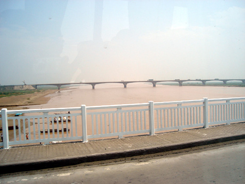
Ordosz mellett a Sárga-folyó:
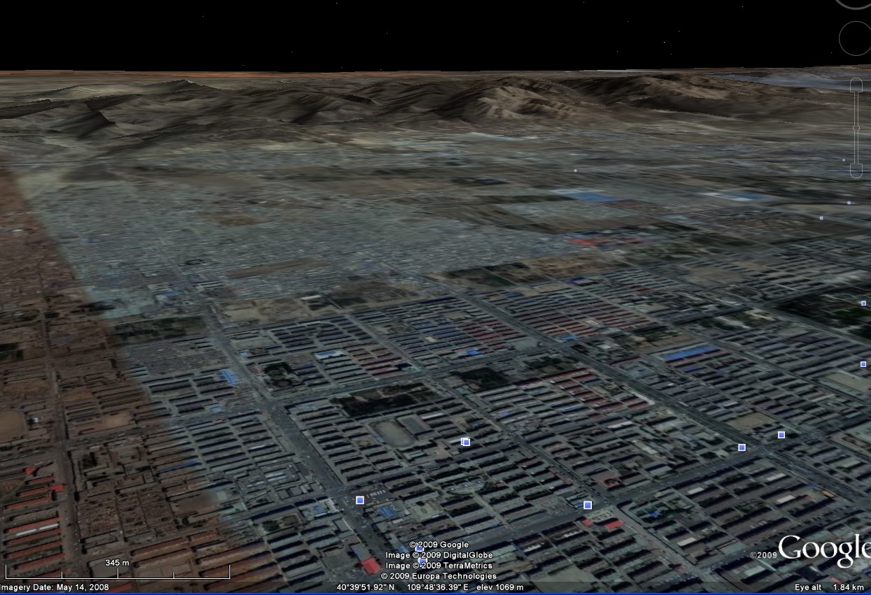
Ordosz feletti hegyek:
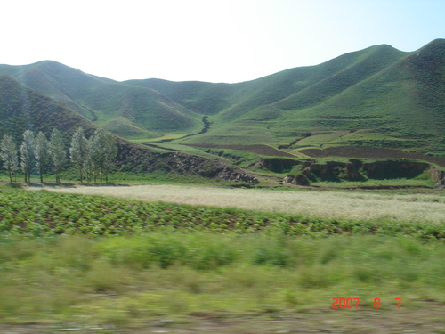
"Farkaslyuk" Ózd mellett és a Hangony
Ózddal szomszédos település „Farkaslyuk”.
A Hangony (Anonymous Gestájában „fluvium Hongun”) az Ózdon átfolyó patak neve, egyben egy, Ózdtól Nyugatra eső település is.
operating instructions
Various functions are available as part of the map.
mouse/touch operation
- moving by grabbing the map with a mouse-click you can move the map around
- overview map using the + button in the bottom right of the map you can expand an overview map
- zooming in and out using the + and - buttons in the top left of the map you can obtain more or less detail in the map
- switching themes or maps clicking on the ≡ icon on the right-hand side of the map you can view and select available maps and themes
- retrieving information the map may contain elements that contain more information, by clicking these a popup will show this information
- fullscreen display using the ✈ button the map can be maximized to fullscreen display, use the ✕ button to return to page display.
keyboard operation
Keyboard operation becomes available after activating the map using the tab key (the map will show a focus indicator ring).
- moving using the arrow keys you can move the map
- overview map using the + button in the bottom right of the map you can expand an overview map
- zooming in and out using the + and - buttons in the top left of the map or by using the + and - keys you can obtain more or less detail in the map
- switching themes or maps clicking on the ≡ icon on the right-hand side of the map you can view and select available maps and themes
- retrieving information the map may contain elements that contain more information, using the i key you can activate a cursor that may be moved using the arrow keys, pressing the enter will execute an information retrieval. press the i or the escape key to return to navigation mode
- fullscreen display using the ✈ button the map can be maximized to fullscreen display, use the ✕ button to return to page display.
It's possible that some of the functions or buttons describe above have been disabled by the page author or the administrator

| id | symbol | latitude | longitude | description |
|---|---|---|---|---|
| Tura útja | ||||
| 1 | 48.224144º | 20.28887º | Ózd |
|
| 2 | 48.187663º | 20.308651º | „Farkaslyuk” |
|
| 3 | 48.229087º | 20.19803º | Hangony település |
|
| 4 | 48.249549º | 20.268594º | Uraj település |
|